


Satellite Integrated Landslide Assessment and Alert System (SILAAS)
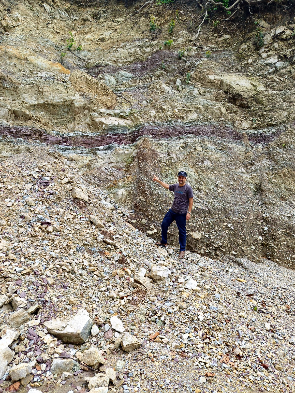
Field Work : SILAAS Project
Satellite Integrated Landslide Assessment and Alert System (SILAAS)
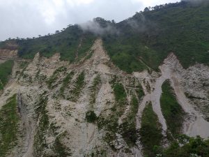
The Uttarakhand Space Application Centre (USAC) is implementing the ‘Satellite Integrated Landslide Assessment and Alert System’ (SILAAS). This project is conceptualized and funded by the National Remote Sensing Centre (NRSC) of the Indian Space Research Organization (ISRO). The aim is to develop a sophisticated landslide alert system in India capable of predicting both where and when a landslide might occur. It involves analyzing, modeling, and measuring static and dynamic parameters that influence landslide disasters.
Currently, Landslide Inventory Mapping for post-monsoon 2023 is underway across 11 hilly districts of Uttarakhand. This inventory is created using object-based image analysis techniques applied to satellite imagery and Digital Elevation Models (DEM), complemented by field validation through the FLIM mobile application.
Objectives of the Current Study
- To prepare a Landslide Inventory for post-monsoon 2023 in Uttarakhand using high-resolution satellite data and DEM
- To conduct ground verification of landslides identified from satellite data
- To collect additional ground landslide data (if any) using the FLIM mobile application and validate landslide alerts in the field (if applicable)
Beneficiary:
Disaster Management, R&D Organizations, Line Departments
Benefits:
Landslides Inventorization, Base Preparation for Predictive Modeling
How To Apply
For more details, visit USAC’s official website ‘www.u-sac.uk.gov.in’